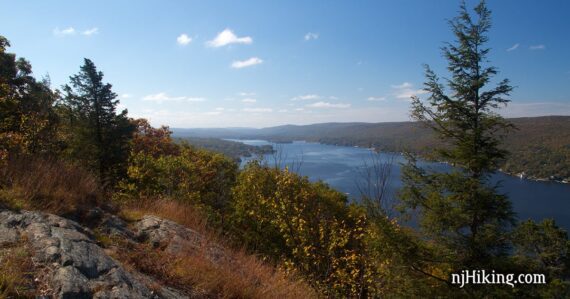
Enjoy big views of Greenwood Lake from Bare Rock and a 360° panorama from Sterling Forest’s fire tower.
8.7 miles. Trails are very well marked, and there are signs posted at junctions to really make things clear.
| 8.7 miles | This hike guide: Detailed instructions, photos, and video follow below. |
| Shorter | 5.8 miles – Bare Rock Trail to Greenwood Lake overlook and back. 4.7 miles – Skip the overlook, and just go to the fire tower [loop from visitor center: BLUE (Sterling Lake Loop) – ORANGE (Bare Rock) – BLUE CIRCLE on WHITE (Sterling Ridge)/TEAL (Highlands) – Fire Tower – WHITE STRIPE on RED (Fire Tower Trail)] |
| Longer | There are multiple trails in the area to extend the route. |
| Nearby | Pine Meadows Loop; Seven Hills, HTS, Pine Meadow; Seven Hills, HTS, Raccoon Brook, Pine Meadow; Almost Perpendicular, Elbow Brush; Black Rock and Hogencamp Mountain. |
Our two cents:
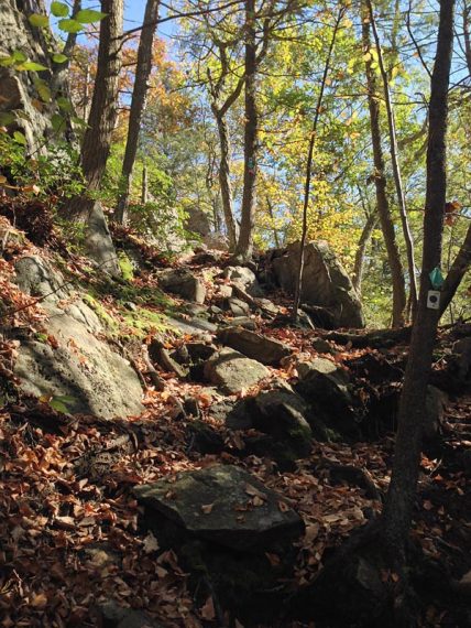
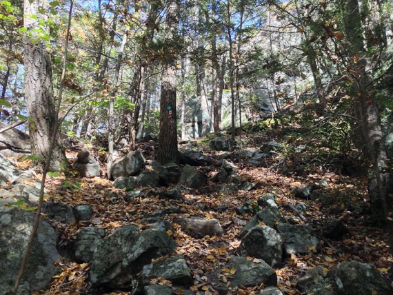
Sterling Forest has a lot of old woods roads that are quite rocky. The approach to the fire tower on the Highlands Trail is up a steep rocky section, with a little scrambling.
Also check out the Sterling Furnace remains. Sterling Forest is just over the NJ-NY border in New York, to the west of Harriman State Park.
Updated: 5/2024 – Page refreshed, not re-hiked. 10/13/13 – Updated description and changes/additions to route: avoiding the flooded section on Fire Tower Trail, added Lakeville Ironworks and South Point trails to end of route.
Hike Info:
Map:
Print the Sterling Forest Map from park’s site or get one at the visitor center. For clarity and a larger coverage area, we really prefer the Sterling Forest Trails.
Books:
A different route in the area can be found in 60 Hikes Within 60 Miles: New York City, four different hikes in Sterling can be found in Take a Hike New York City.
And for the history of the park, check out: Saving Sterling Forest: The Epic Struggle to Preserve New York’s Highlands
Parking: N41 11.865 W74 15.358
Parkway N to cross into NY, to 87N to exit 15A for 17, to 72 (Sterling Mine Road) to right onto 84 (Long Meadow Road). Follow signs to visitor center.
Lot is on the right. Walk across the road to the Visitor Center (which has several displays, a ranger, maps).
Restrooms:
Regular bathrooms in the visitor center.
Hike Directions:
Overview: Route: BLUE (Sterling Lake Loop) – ORANGE (Bare Rock) – Spur trail to viewpoint and back to ORANGE (Bare Rock) – WHITE STRIPE on RED (Fire Tower Trail) – Unmarked Trail – BLUE CIRCLE on WHITE (Sterling Ridge)/TEAL (Highlands) – ORANGE (Bare Rock) – BLUE (Sterling Lake Loop) – YELLOW PICKAXE (Lakeville Ironworks) – BLUE (Sterling Lake Loop) – ORANGE (South Point)
0.0 – Walk from the lot across the street to the visitor center. Facing the door… turn LEFT onto BLUE.
Follow it along the sidewalk and across a small grassy area into the trees.
0.3 – Look for the YELLOW PICKAXE (Lakeville Ironworks) trail on your left and take a very short side trip to check out the old Sterling Furnace.
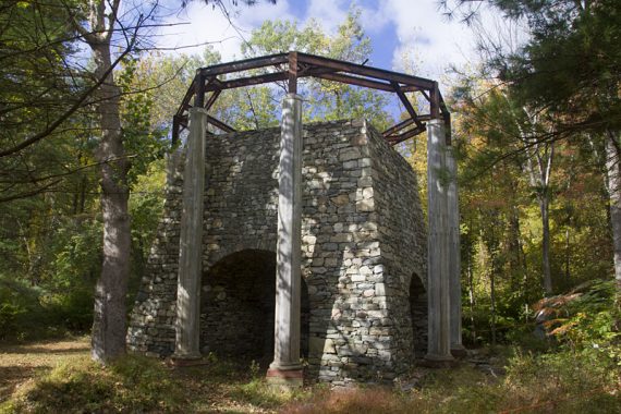
*Sterling Furnace Fun Facts: The original was built in 1751 and was used to produce iron ore. If you are going, “wow, this is in really good shape”, it’s because this is a reconstruction from the 1950s.
The ‘dome’ structure was added at that time and not part of the original.
Backtrack to the BLUE (Sterling Lake Loop) and turn left to continue. Cross a small bridge, with Sterling Lake visible on the right.
The trail turns LEFT, avoiding private property. Soon you come to the road (which is actually BLUE (Sterling Lake Loop)), turn RIGHT and walk on the road.
Sterling Lake will be on the right, with a few viewpoints. Remains of buildings are along the park road.
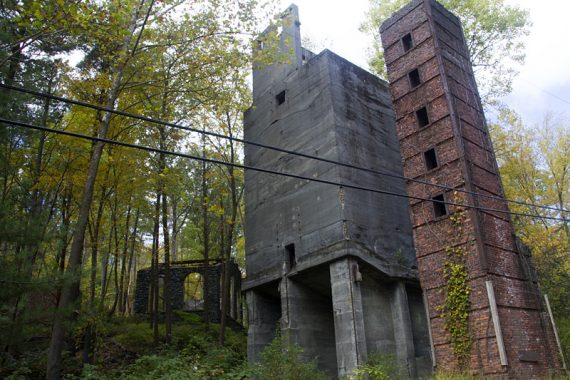
0.8 – Turn LEFT and start following ORANGE (Bare Rock) into the forest, leaving the road.
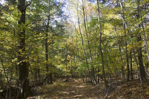
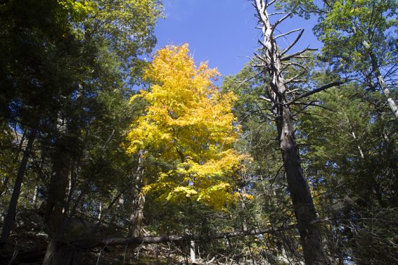
1.5 – Continue straight on ORANGE (Bare Rock) as BLUE (Sterling Ridge)/TEAL (Highlands) crosses the trail.
Cute little Eastern Ribbon Snake – only about two feet long:

2.0 – ORANGE (Bare Rock) curves to the left .
[GREEN (West Valley) comes in from the right and is co-joined with ORANGE (Bare Rock) for a bit]
2.2 – Turn RIGHT to continue on ORANGE (Bare Rock). [GREEN (West Valley) continues straight]
2.8 – Turn RIGHT at the sign for the spur trail to the Greenwood Lake overlook. This is a really nice spot for a break, with a wide view of the lake.
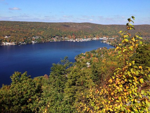
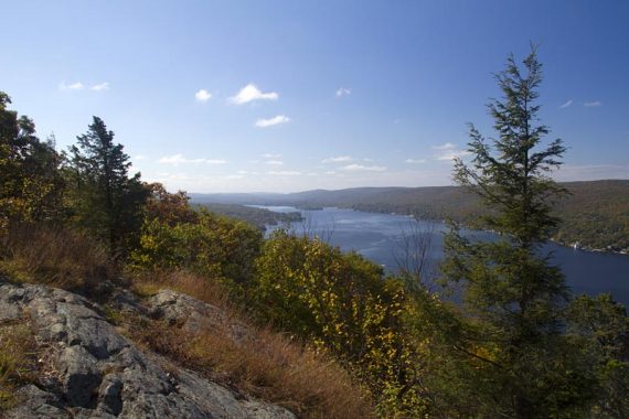
When ready, retrace your steps, turning RIGHT back onto ORANGE (Bare Rock).
4.6 – ORANGE (Bare Rock) ends at a T with a woods road that is marked WHITE STRIPE on RED (Fire Tower Trail)/GREEN (West Valley) in both directions (the markers may not be obvious, both are away from the intersection a bit).
Turn RIGHT, now following WHITE STRIPE on RED (Fire Tower Trail)/GREEN (West Valley).
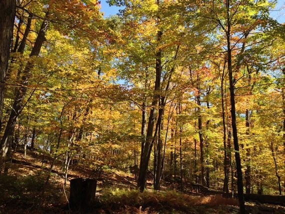
4.7 – Turn LEFT onto an unmarked trail.[Easy to miss] The unmarked trail becomes blazed with WHITE, but we didn’t spot a marker at the turn.
4.9 – Turn LEFT, now following BLUE CIRCLE on WHITE (Sterling Ridge)/TEAL (Highlands). [BLUE CIRCLE on WHITE (Sterling Ridge)/TEAL (Highlands) also goes to the left]
5.1 – At a junction with a woods road and a sign for Sterling Ridge, continue straight, following BLUE CIRCLE on WHITE (Sterling Ridge)/TEAL (Highlands)/WHITE STRIPE on RED (Fire Tower Trail).
[The WHITE STRIPE on RED (Fire Tower Trail) also goes left. The trail to the right is blocked with branches and marked ‘keep out’ on the map]
5.2 – Head steeply uphill with a bit of a scramble over rocks, to an overlook on some rocks on the side of the trail.
Continue following BLUE CIRCLE on WHITE (Sterling Ridge)/TEAL (Highlands)/WHITE STRIPE on RED (Fire Tower Trail).
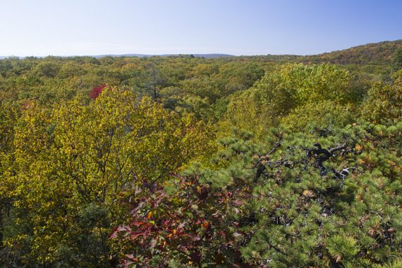
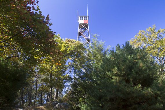
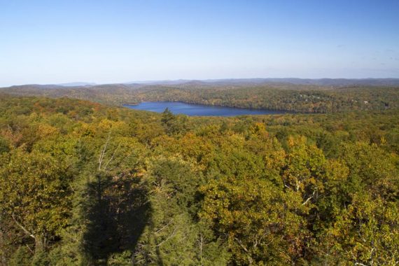
5.7 – Arrive at the Sterling Ridge Fire tower. If it’s open, you can climb up for wonderful 360° views.
Even if you hate heights, the view is worth giving it a try – you don’t need to go all the way up to the top in order to see over the tree line, either.
There is worn out wood on one of the lower platforms that looks iffy but it’s fine, and the rest aren’t like that. There is a picnic table at the base of the tower.
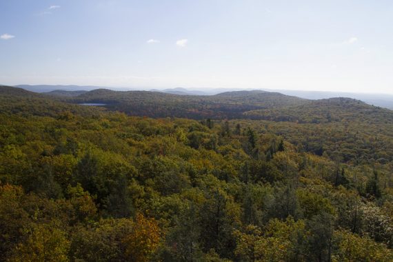
View from the Fire Tower – Sterling Lake in the distance:
Interesting bug half way up the tower:

After the tower, walk down to the wooden trail kiosk, turn LEFT to continue following BLUE CIRCLE on WHITE (Sterling Ridge)/TEAL (Highlands). [no longer also following RED (Fire Tower Trail)].
6.3 – Pass a viewpoint where you can see Sterling Lake.
6.6 – Turn RIGHT onto ORANGE (Bare Rock) – you were here earlier.
7.3 – Turn RIGHT onto the park road, BLUE (Sterling Lake Loop).
7.5 – Turn RIGHT onto YELLOW PICKAXE (Lakeville Ironworks) and follow the trail past the remains of old buildings and a closed mine.
/// Shorter option: Don’t turn onto YELLOW, retrace the route from earlier by staying on the park road and taking BLUE (Sterling Lake Loop), back to the visitor center. ///
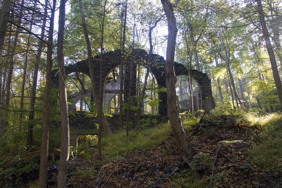
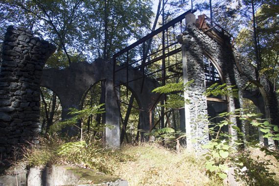
7.8 – Still following YELLOW PICKAXE (Lakeville Ironworks), cross the park road, go over a small bridge, past a building, cross the road again and arrive back to the Sterling Furnace.
8.0 – Turn RIGHT onto BLUE (Sterling Lake Loop) and follow that back to the visitor center.
8.2 – Back at the visitor center, go around to the right side and start following ORANGE (South Point).
/// Shorter option: End the hike at the visitor center and don’t take ORANGE (South Point) to reduce the hike by 0.5 miles. ///
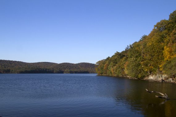
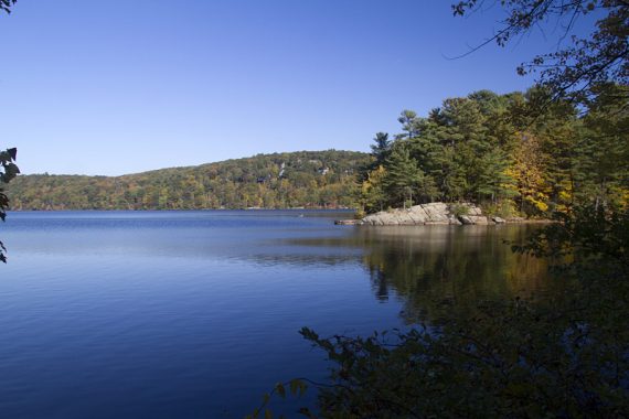
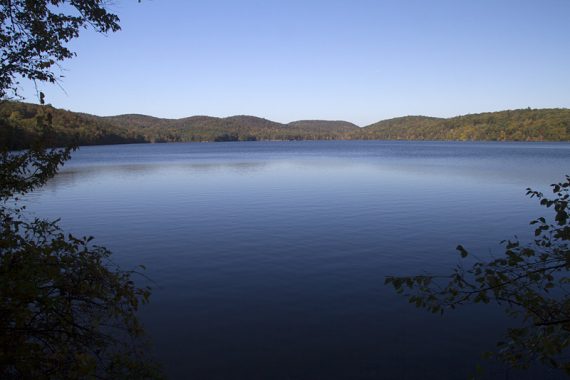
This short trail hugs the shoreline to another view of Sterling Lake. When done, retrace the route back to the visitor center and parking lot.
—
Hiked 10/13/13.
Hiked 8/15/10. Trail Blog: “Sterling Forest – Bare Rock, Fire Tower Loop“
Hiked 8/25/08. Trail Blog: “Sterling Forest – Allis Trail to AT North out and back“
Hiked 8/17/08. Trail Blog: “Sterling Forest – Sterling Ridge Trail“