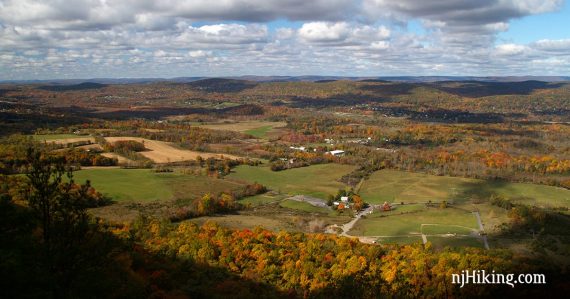
Hike the “Stairway to Heaven” up a series of steep rock slab steps to a panoramic view from Pinwheel’s Vista.
Miles: 2.6 total, round trip. Trail surface is dirt and roots with extremely rocky sections. Very steep.
| 2.6 miles | This hike guide: Detailed instructions, photos, and video follow below. |
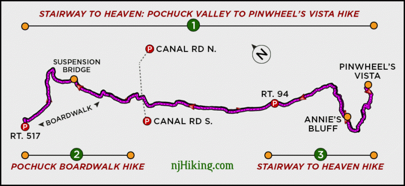
| Note: There are three popular hikes on the Appalachian Trail in this area, shown on the diagram below: 1. Stairway to Heaven: Pochuck Valley to Pinwheel Vista – 7.3 miles. 2. Pochuck Boardwalk – Appalachian Trail – 2.0 miles. 3. Stairway to Heaven NJ – This hike. | |
| Nearby Hikes | Cedar Swamp and Lake Lookout; Lake Loop and Twin Bridges; Hoeferlin, Cedar Swamp, Red Dot; Iron Mountain and Hoeferlin Loop; Wallkill River NWR. |
| Nearby Kayaking | Wawayanda Lake via Kayak. |
Our two cents:
Short but steep rocky hike with a stunning view as a reward, but very popular. Excellent for fall foliage.
Post hike: Nearby… Heaven Hill Farm market (ice cream, bakery), Roadside Cafe (hot dogs). On Rt. 515… Daily Bean (coffee, sandwiches, garden seating).
Note: The video on this page is for the longer hike version that includes the Pochuck Boardwalk.
Updates: 12/2024 – Minor edits. 2/2022 – Trail map info. 10/2021 – Re-hiked, minor description changes, more photos, added optional A.T. mailbox extension.
Hike Info:
Map/Books:
Northern New Jersey Highlands Trails Map map set. Follow along on your smartphone with our Interactive Map link above. 50 Hikes in New Jersey and Hiking the Jersey Highlands have this route. Hiking New Jersey (2023) has a detailed description and a diagram of the longer 7.4-mile route.
Restrooms:
None. Gas stations and fast food in Butler (more options), or in Vernon. Nearby farm market may have portable toilets.
Parking: 41.219472, -74.455083 [Route 94 lot]
443 Vernon Warwick Rd, Vernon Township, NJ 07462.
Rt 287 to Rt. 23. Follow 23 to the exit for 515N. Continue Rt 515/Rt 94/Vernon Warwick Rd. Limited parking. Small dirt lot on right with room for 5 or 6 cars at the trailhead.
Just past this is room for several more cars along the road, followed by another larger dirt lot near a hotdog stand. If full, it’s possible the nearby farm may offer parking for a fee (unconfirmed).
Hike Directions
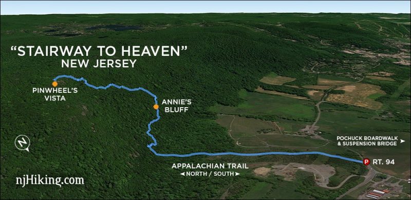
Overview: Appalachian Trail (WHITE) – BLUE spur trail – Appalachian Trail (WHITE)
0.0 – From the parking lot, start following Appalachian Trail (WHITE). The trail is easy until the woods. Shortly after that, pass through a large boulder field.
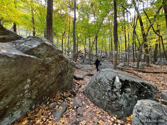
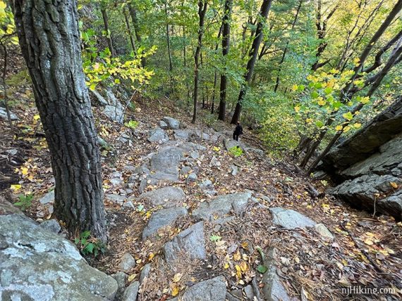
The trail becomes very rocky and starts the steep climb up Wawayanda Mountain.
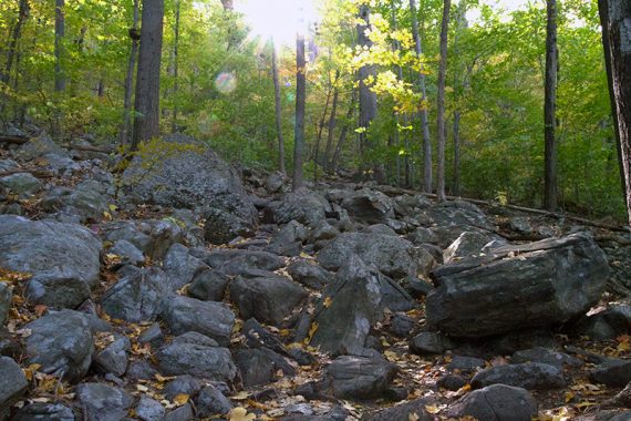
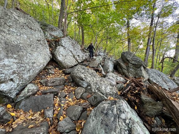
0.7 – “Annie’s Bluff” – A limited viewpoint, near a large rock after a bit of a steep climb. Easy to miss.
This point is just a bit more than half-way to Pinwheel Vista and it gets steeper and rockier from here. If the trail is already more than you bargained for, this is a good bail out point to head back down.
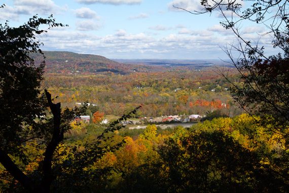
Notice that slabs of rock are placed as steps along the way – the “Stairway to Heaven”.
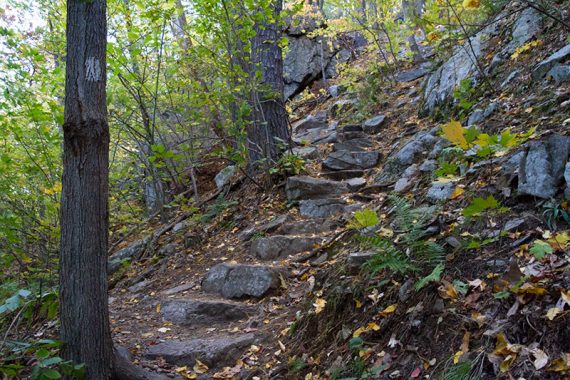
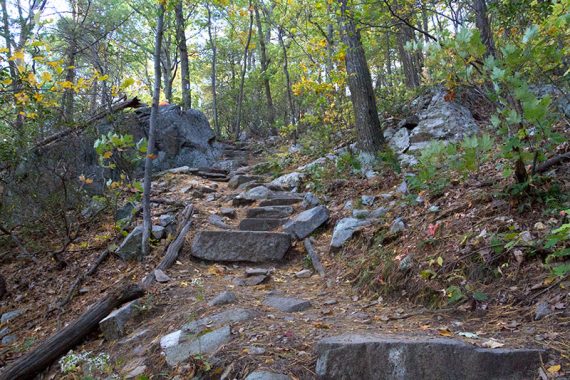
Follow the WHITE markers to stay on the trail. Sometimes there are signs and rope guidelines to keep hikers on track. Straying off the path can cause trail erosion.
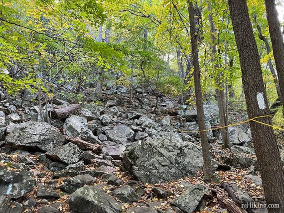
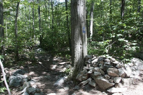
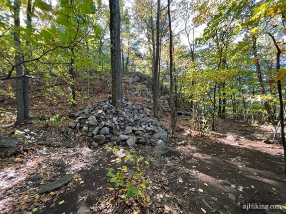
1.2 – Veer LEFT and now follow a BLUE spur trail to Pinwheel’s Vista. This is marked by BLUE blazes and a very large cairn (hiker’s term for pile-o-rocks used as a trail marker).
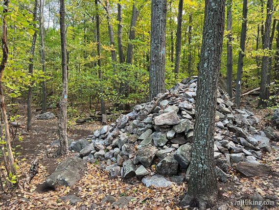
Sometimes there is a sign for the vista (new was added in 2024). This side trail can be easy to miss, look for the rock pile to make the left turn onto the BLUE spur trail.
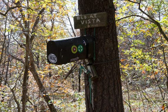
[Appalachian Trail (WHITE) continues ahead – If you arrive at a mailbox with an Appalachian Trail log book in it, you’ve missed the turn for Pinwheel Vista].
The size of the rock pile placed at the junction to call attention to the turn has increased exponentially over the years. The photo above is from 2021 while below is 2015 and then 2009.
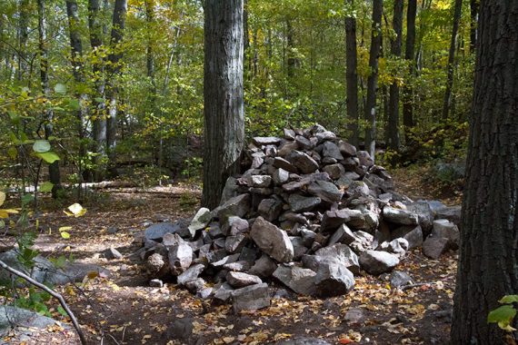
Follow BLUE to a rock outcrop called Pinwheel’s Vista where there are several places to sit and enjoy the view. To enjoy the view from several different angles, we usually follow the BLUE trail to the end and work our way back along the outcrop.
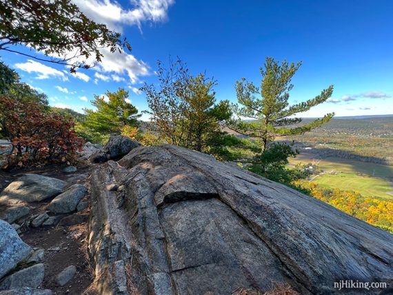
Fun Fact: “Pinwheel” was the nickname of Paul DeCoste, who helped build this section of trail. [Source: NY-NJ Trail Conference].
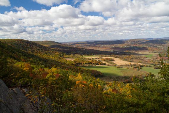
The Kittatinny Mountains are visible in the distance and farms in Vernon Valley below.
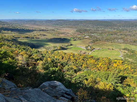
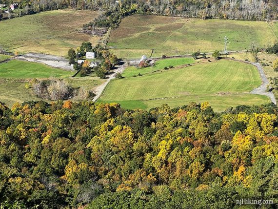
Kittatinny Ridge in the far distance, Pochuck Mountain in front of it, with Heaven Hill Farm in the valley below (where you too may find yourself shoveling cider donuts in your face post hike…).
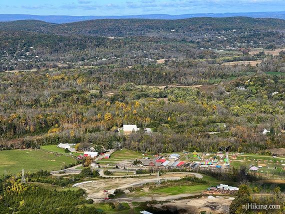
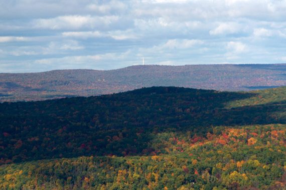
On a clear day High Point Monument can be seen across the valley along the Kittatinny Ridge (the second ridge, the one in front is Pochuck Mountain).
Binoculars/monocular/zoom lens are helpful since the tall white obelisk can blend into the sky.
It may also be possible to see the Shawangunks and Catskill Mountains in New York far in the distance off to the right.
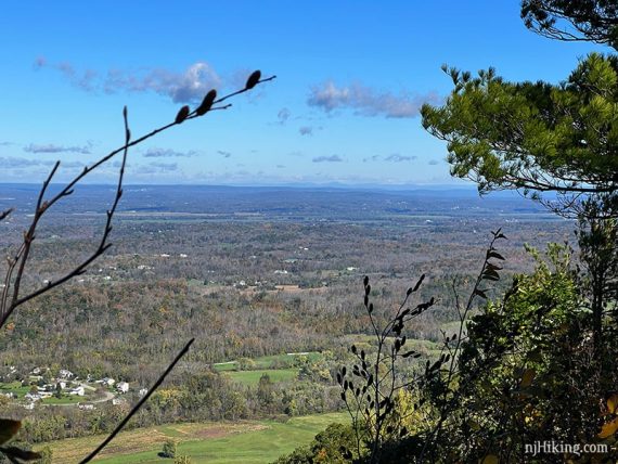
When done, retrace the route back – follow BLUE back to the rock pile and veer RIGHT back on to Appalachian Trail (WHITE) – or take the optional extension below first.
Follow Appalachian Trail (WHITE) back down the Stairway to Heaven to the parking lot.
// Optional extension, adds 0.2 miles total, round trip. //
For a short trip to the Appalachian Trail mailbox… After Pinwheel Vista, walk back to the pile of rocks and turn LEFT instead.
Follow the Appalachian Trail (WHITE) up a rock-studded hill to a mailbox attached to a tree that contains an Appalachian Trail log book for thru-hikers to sign. A new mailbox was installed in 2024, this photo is an older version.
Retrace steps back to the pile of rocks and continue following Appalachian Trail (WHITE) back down to the parking lot .
—
Hiked 10/19/21.
Hiked 10/17/15. From Pochuck Valley.
Hiked: 7/31/10. Trail Blog: “Stairway to Heaven: Pochuck Valley to Pinwheel Vista“