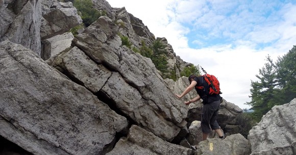
A short, fun, challenging rock scramble up Bonticou Crag and a hike to Table Rocks in New York’s Mohonk Preserve.
5.6, 3.9 or 2.3 miles. Ranges from dirt woods roads to somewhat rocky trail; challenging rock scramble up Bonticou Crag.
| 5.6 miles | This hike guide: Detailed instructions, photos, and video follow below. |
| Shorter | 3.9 miles – Skip Table Rocks. Noted below. 2.3 miles – Bonticou Crag loop only. Noted below. |
| Variation | Skip the scramble but get to the view. Noted below. |
| Nearby | Gertrude’s Nose; Labyrinth and the Lemon Squeeze; Sam’s Point Preserve – Ice Caves, Verkeerder Kill Falls, High Point. |
| Combine two hikes into getaway | “The Gunks Overnighter: Sam’s Point and Bonticou Crag“ |
Our two cents:
The Bonticou Crag rock scramble and the views from the top are the stars here and are a must-do. The rest of the hiking in this area is ok and while Table Rocks is worthwhile and has a nice view – it’s not overly enthralling.
The scramble itself is maybe 20 minutes up. The difficulty is really subjective. To me it’s a fun, but difficult, challenge. Taller hikers will probably have an easier time. There isn’t a shear, deadly drop off (i.e. Angel’s Landing in Zion) but a stumble or fall could be serious.
Be sure to watch our video embedded on this page to see what it’s like, especially if you’ve never done scrambling before, and check out the section comparing it to other scrambles.
However, you can skip the scramble but still get the view from the top of Bonticou Crag… At the base of the scramble is an option to bypass it by hiking on regular trails up to the viewpoint above it – directions are noted below. This is a great option if you decide to bail once you see it in real life, or if people you’re hiking with want to skip it – everyone can meet at the top and enjoy the view.
Don’t do if wet or icy. Probably not good for small kids or dogs. Consider leaving the trekking poles and large cameras behind, they can get in the way. For avid hikers, just doing Bonticou Crag is too short a day so we recommend combining it with Table Rocks.
The scramble is popular but we’ve done this early morning on a summer Friday and Tuesday and had it to ourselves both times. The white rock of the Shawangunks really make the leaf colors pop in Fall foliage season.
Updated: 8/2024 – Re-hiked; updated the post, added/replaced photos, added more detail on the climb. Older change log at page bottom.
Hike Info:
Map/Books:
Shawangunk Trails is recommended. A map may be available at the lot to purchase, or check the Mohonk Preserve web site. Follow along on your smartphone with our Interactive Map link above.
Take a Hike New York City has Bonticou Crag and Table Rocks as separate hikes; “Best Day Hikes in the Catskills and Hudson Valley“ and 50 Hikes in the Lower Hudson Valley have Bonticou Crag.
Scenes & Walks in the Northern Shawangunks describes the trails and carriage roads in Minnewaska, Mohonk, and Sam's Point, featuring beautiful illustrations, maps, and historical background.
Parking: N41.79517° W74.12804°
Mohonk Preserve Spring Farm Trailhead. Address is 50 Upper 27 Knolls Rd, High Falls, NY 12440 but it might direct you just past the entrance to the lot. From NJ… Rt. 87 to New Paltz exit 18. Rt 299 W – Springtown Road – Mountain Rest Road – Upper 27 Knolls Road.
Per hiker fee: $15. If the gatehouse in not staffed there is a metal post with fee envelopes where you rip off the permit flap to keep with you. Exact change required (or, let them keep the change as a donation), no electronic payment (maybe when it’s staffed but we’re always here first thing). Preserve lands are open daily sunrise to sunset.
Restrooms:
Composting toilet in the parking lot was unlocked.
Refreshments/Overnight:
Nearby New Paltz has a main street packed with restaurants, coffee, ice cream, and there’s a farm stand just outside the city. On our last visit we hit Clemson Bros. Brewery as usual for dinner and a pint, and tried Lola’s Cafe the next day (tasty sandwiches) because the falafel place we always go to was sadly gone.
From north New Jersey this is close enough for a day trip… but from central or south this is 2+ hours away and you may as well make it an overnighter! This is an easy and fun way to get two hikes in.
This last trip we again stayed at America’s Best Value Inn (affordable, clean, basic, simple breakfast). We’ve also stayed at the Hampton Inn next to it which is a bit nicer (but on this past trip would have been nearly double the price!).
We’ve got a couple Trail Blogs in our On The Road section with suggestions on how to combine hikes into an overnight trip.
How does Bonticou Crag compare to other scrambles?
This is sort of, but not quite, like a much shorter Breakneck Ridge (we did this years ago but haven’t created a guide on the site).
Nearby Labyrinth and Lemon Squeeze in Mohonk is much longer than the Bonticou scramble and has sections of rocks to squeeze in and around which makes it more physically demanding.
Climbing Bonticou Crag is harder than the Giant’s Stairs in New Jersey’s Palisades. That scramble section is much longer and horizontal. Here the rocks are larger, you need to reach more, and you’re going steeply up.
If you’re familiar with the short sections of scrambling we get on New Jersey area trails, such as Surprise Lake Loop via State Line, this is harder but if you can manage that you can probably do this.
Hike Directions:
Overview: Table Rocks (BLUE) – Crag Trail (RED) – Bonticou Road (RED) – Crag Trail (RED) up the scramble – Bonticou Foot Path (YELLOW) – Northeast Trail (BLUE) – Clearwater Road (RED) – Table Rocks (BLUE) – Farm Road
There is a large network of trails and carriage roads, and it can be confusing. Overall, to get to the scramble it’s BLUE then RED, basically following signs for Crag Trail… though the trail names change and there are many intersections.
Note: The rock scramble is now blazed RED, it used to be YELLOW. The description has been updated but some of our photos still show YELLOW for the scramble portion.
0.0 – From the Spring Farm lot, cross the road from the gatehouse and turn LEFT onto Table Rocks (BLUE), heading towards Crag Trail (RED). If you’ve parked further down the parking lot, also cross the road and look for signs to access the trail, and also follow Table Rocks (BLUE) towards Crag Trail (RED).
0.1 – Turn RIGHT onto Crag Trail (Red). [Table Rocks (BLUE) continues ahead].
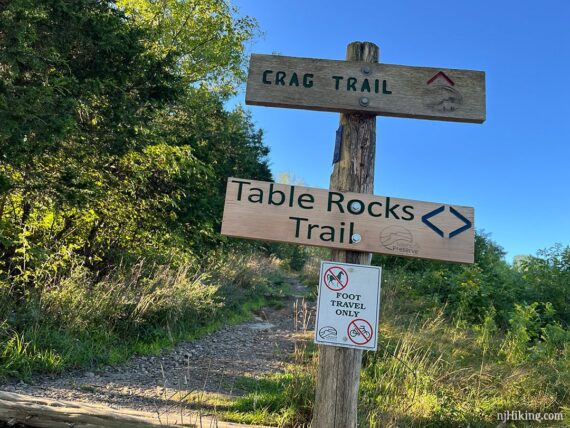
In just a bit Crag Trail (RED) curves to the left, marker might not be obvious, while an unmarked path goes through a field ahead. Crag Trail (RED) crosses two carriage roads in quick succession – Cedar Drive then Spring Farm Road.
0.7 – Crag Trail (RED) comes to an intersection with a sign (facing the other way) for Bonticou Road and Cedar Drive and a bike repair station. Turn LEFT (but not the very sharp left) onto Bonticou Road and follow this carriage road as it curves around.
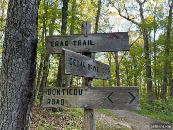
1.0 – Turn LEFT onto Crag Trail (RED).
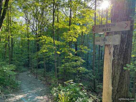
Follow Crag Trail (RED) across Northeast Trail (BLUE), and arrive at the base of the Bonticou Crag rock scramble. Here you can size up Bonticou Crag and get a feel for what is up next.
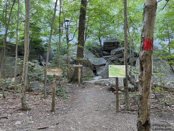
// Want to skip the scramble? You can still get to the viewpoint on Bonticou Crag by turning LEFT on Northeast Trail (BLUE) and follow that up to Bonticou Foot Path (YELLOW) which meets up with the viewpoint above the scramble.
The scramble is a little tricky right at the start. We’ve often found that scrambly hikes like this will do this, as a way to show you what you’re in for so you can bail before you’re in too deep.
Basically like a “You Must Be This Tall to Ride” sign at an amusement park.
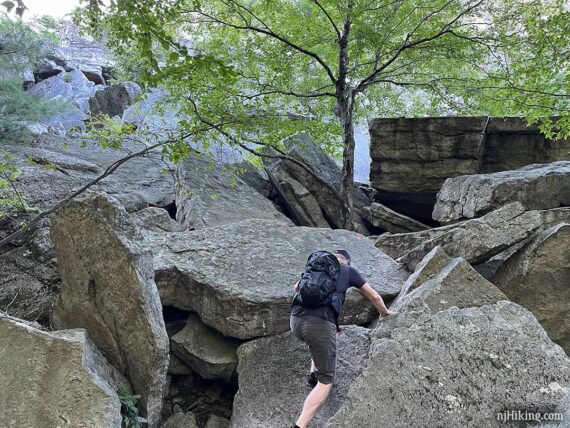
From the base of the rocks, looking up Bonticou Crag.
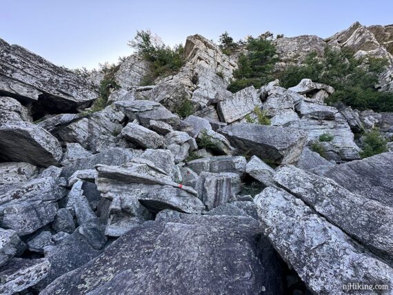
Follow the RED blazes painted on the rocks, using both hands and feet to balance and climb up the large rocks.
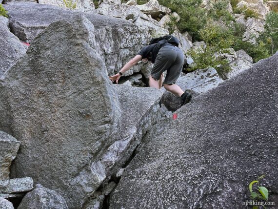
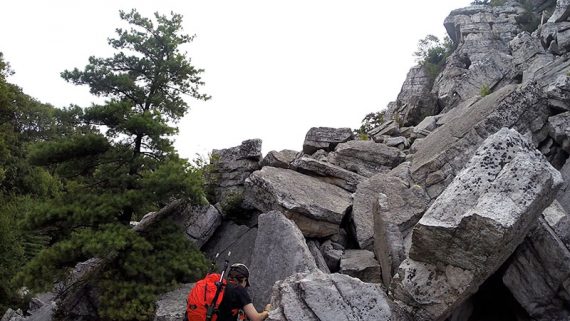
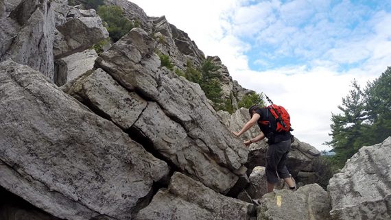
Pretty early on in the route, probably less than 5 minutes, is the one spot I struggle with. Even if I’d thought to take a photo, it doesn’t appear hard. You’re facing a crack between rocks where you’ll need to find a spot on top to grab and then hoist yourself up.
Where you’re standing is awkward, there aren’t great footholds, there are gaps to step over, and it feels like you are leaning down to the left. So when you go to heave yourself up you get the sensation you might fall down to the left or into a crevice… even though you won’t.
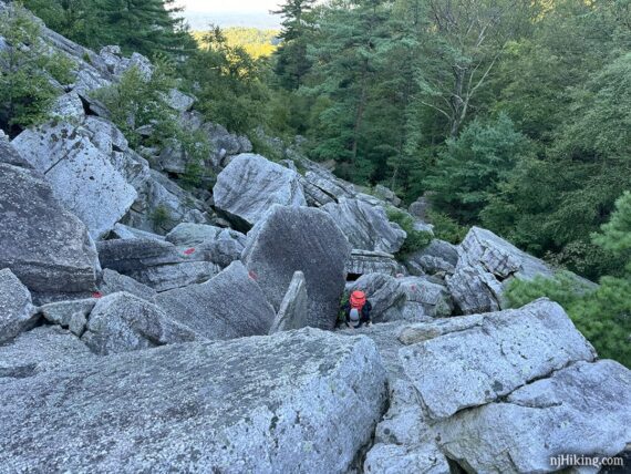
I was again stuck here for several minutes, trying to figure a way up, but mostly just trying to get out of my own head and go. Eventually I shimmied up on my side somehow – very inelegantly.
Point is… if you’re not tall you might want to have a someone be behind so they can spot you here. That was my intention but this came up much sooner than I recalled and I’d told Tom to go ahead for a bit so he wasn’t stuck behind my slow scrambling.
Looking down and over the rock jumble. These rocks have broken from the cliff face over gazillions of years and made a big pile. I assure you that gazillions is an actual geological term.
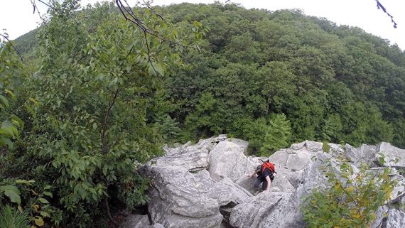
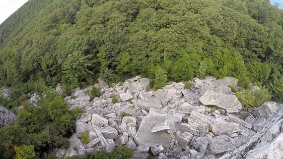
This gives a good overview of the scramble, taken from about half-way through.
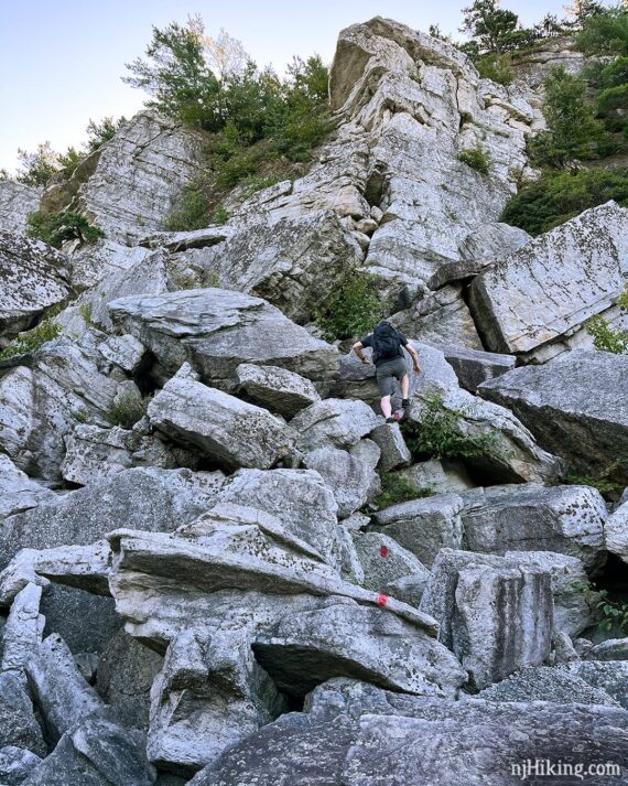
Climb up this long flat slab of rock, tilted a bit of an angle and with a drop-off to rocks just below.
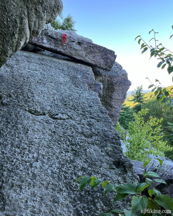
Almost at the top is a narrow chimney crevice where you need to pull yourself up (or get your buddy/significant other/friendly stranger to give you a helpful boost/shove).
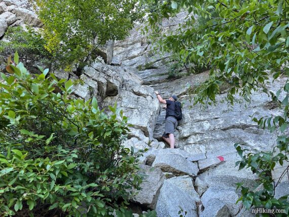
Wide angle pic shows how the rock split off so there is a crevice against the cliff. We call this a chimney… perhaps I read that somewhere…. or perhaps I made that up (entirely possible)… don’t recall… either way we’re sticking with it.
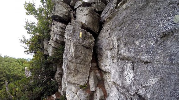
The chimney actually looks easier in photos than in real life. On my second time here I tried removing my pack and squeezing further back in the crevice to stand on the higher ground before trying to haul myself up – unsure if this was better or worse than last time.
This is another spot that being taller or having a someone spot you might help. I hauled myself up on my own – again very inelegantly – but Tom was there to lend a hand/boost if I needed it.
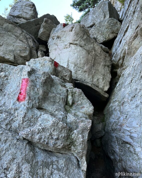
Looking back at the top of the chimney. This is the last scramble, you’re just steps from the top now.
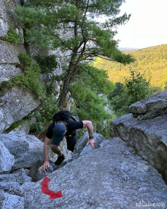
Come up to a flat rock outcrop. Look down (carefully) to see where you came from as well the sides of the cliffs around you. Continue hiking up to the top of the crag.
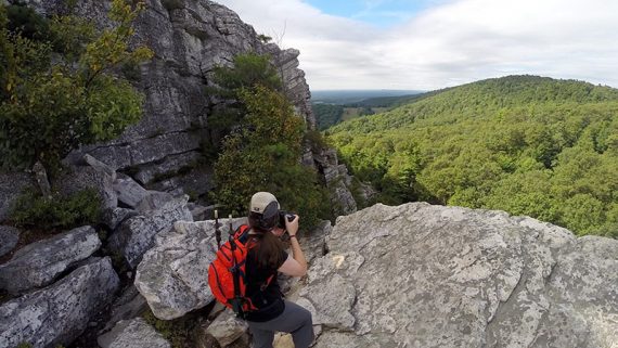
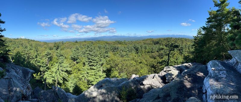
At the top, Crag Trail (RED) ends. Bonticou Foot Path (YELLOW) goes LEFT and will be where this route continues… BUT FIRST, turn RIGHT and make your way out along the rock to enjoy the expansive views over the valley and the Catskill Mountains in the distance.
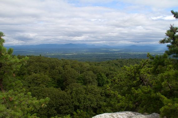
Views from the top of Bonticou Crag. Pine trees are warped by the wind. Lots of places to take a break and soak in the view.
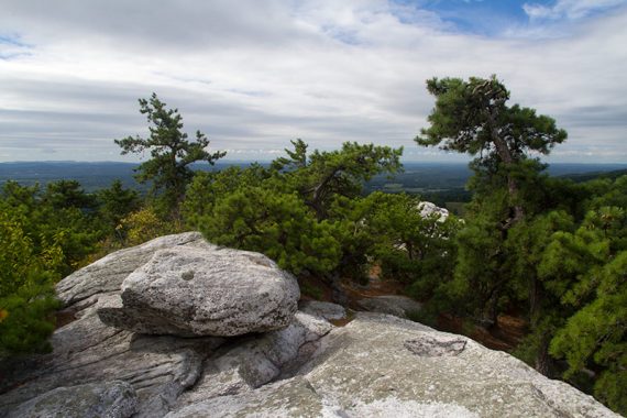
Follow this spine of rock as far you’d like, then return to the Bonticou Foot Path (YELLOW) sign.
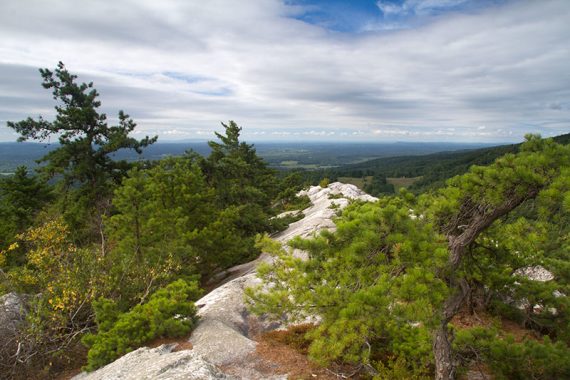
The highest spot on Bonticou Crag is only 1,194 feet but it feels like you’re higher.
By comparison… if you’re at High Point State Park in New Jersey that is 1,803 feet. And if you’ve hiked to the top of Mt. Tammany (of course you have, right?) that is 1,527 feet.
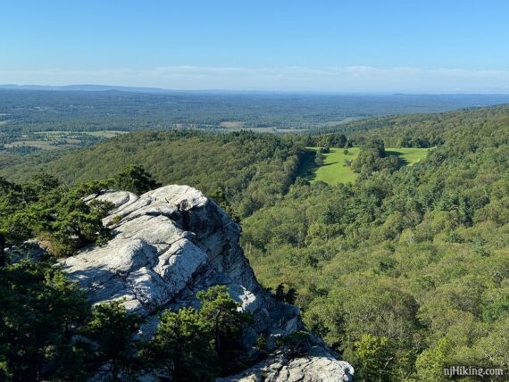
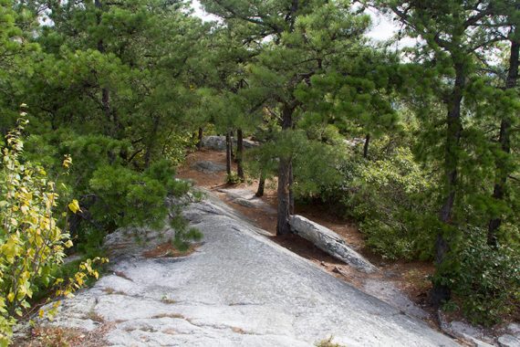
1.2 – Now follow Bonticou Foot Path (YELLOW) from the top of the crag. This follows a regular hiking trail steadily downhill.
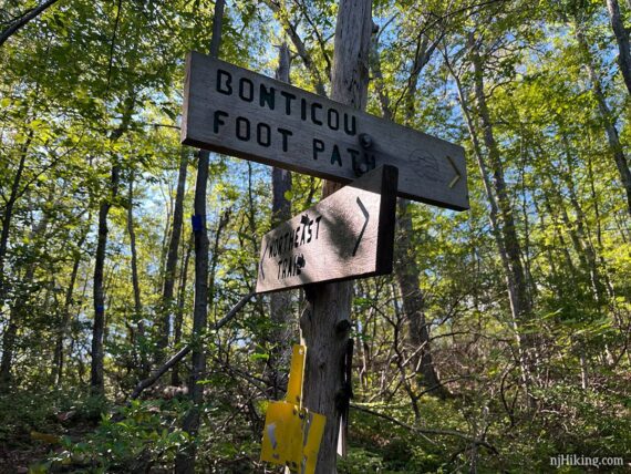
1.5 – Turn RIGHT to now follow Northeast Trail (BLUE).
//Shorter option, 2.3 miles total round trip – Instead, follow the signs with a car and arrow for the shortest route back to the lot, skipping Table Rocks: Turn LEFT on Northeast Trail (BLUE) to Cedar Trail (RED) to Cedar Drive to Table Rocks (BLUE).
Continue following Northeast Trail (Blue). The Catskills can be seen in the distance from a couple of viewpoints.
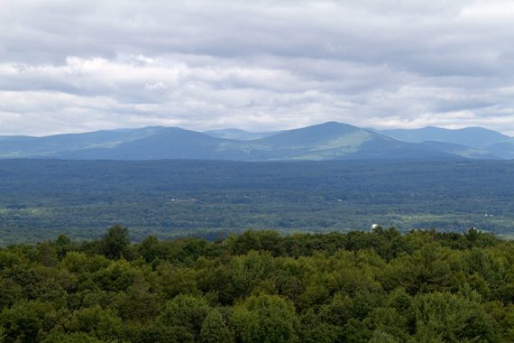
2.4 – Turn LEFT on Clearwater Road (RED). There are trail signs for Northeast Trail and Clearwater Road. Clearwater is a narrow trail before it opens up into a woods road. Pass an unmarked connector trail on the left.
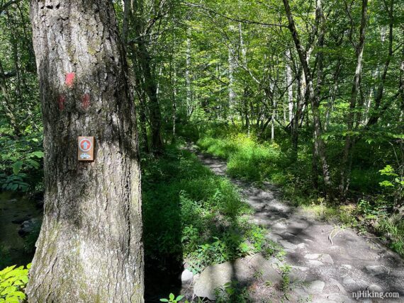
2.8 – Clearwater Road (RED) ends at an intersection with Table Rocks Trail (BLUE) and a sign pointing to Farm Road and the lot. Continue ahead and veer right to now follow Table Rocks Trail (BLUE). [Table Rocks Trail (BLUE) also goes left – return to here after visiting Table Rocks.]
//Shorter option, 3.9 miles total round trip: Instead, turn LEFT and now follow Table Rocks Trail (BLUE). Rejoin the description at 4.5 below.
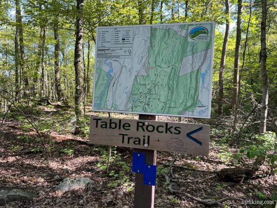
Table Rocks Trail (BLUE) heads steadily downhill on a woods road filled with small rocks, then levels out into a better woods road. We find this trail to be a bit of a grind, to be honest.
3.5 – Turn LEFT to head over to Table Rocks. Meander around very large boulders, then the trail splits in a loop. We went to the right (either way is fine, it’s very short loop or you can out-and-back it).
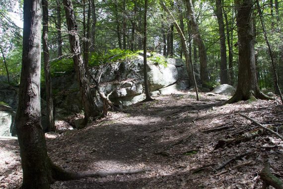
The blue blazes kind of disappear for a moment – step up on rocks and continue following BLUE out to an open area, Table Rocks, where a large cracked rock face is at a relatively steep angle. There’s a nice view across to the Catskill Mountains.
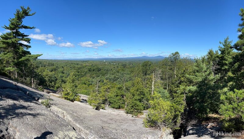
There are open crevices where the rock has split, so be mindful of where you step. They can be VERY deep.
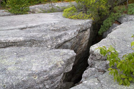
To really see more crevices you’d have to make your way down the angled face and step over cracks. And obviously don’t do that if wet or icy.
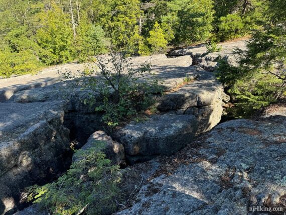
Both times we’ve been here we just didn’t feel it was worth wandering down the angled slab and walk over gaps to see more crevices or fractured rock. Somewhere here is a crack with a wedged rock you can walk over. Neat, sure, but not worth it for us.
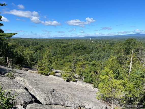
After enjoying the view and checking out the crevices, retrace Table Rocks Trail (BLUE) back.
4.5 – Back at the intersection from earlier, continue following Table Rocks Trail (BLUE). In a few steps arrive a sign at the intersection with Farm Road.
Veer RIGHT to continue on Table Rocks Trail (BLUE). (Farm Road meets up with it in a bit, so you can take that too and end up at the same spot).
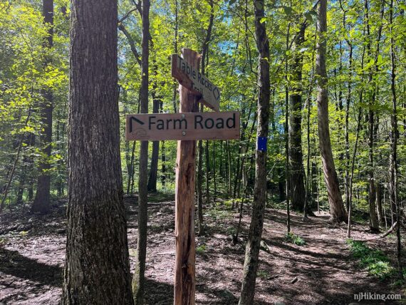
4.8 – Turn RIGHT and now follow Farm Road. [Table Rocks Trail (BLUE) continues ahead and also returns to the lot, but Farm Road is more direct].
Hike through a variety of grassy paths through meadows, don’t recall too many markings but it’s kinda obvious which direction to go.
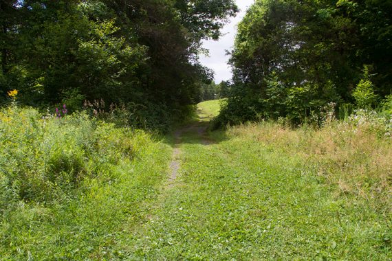
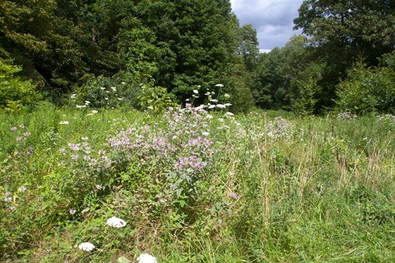
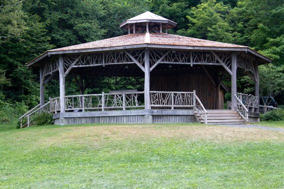
5.2 – Arrive at a signpost at grassy area with a large gazebo across the field.
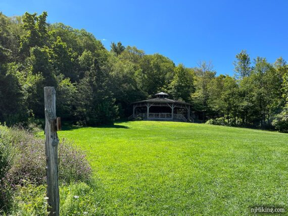
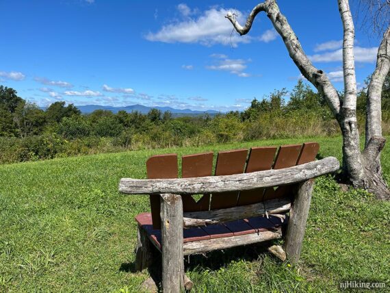
Farm Road continues past the gazebo. But FIRST you might want to pop over to the bench on the right for a view of the Catskill Mountains in the distance.
Continue on Farm Road past the gazebo/pavilion and some outhouses (locked when we hiked but you’ll be back at the lot very shortly).
Continue on Farm Road as it winds it’s way back – in a few moments reach an open area where it turns to the RIGHT before winding back to the LEFT.
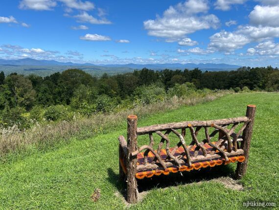
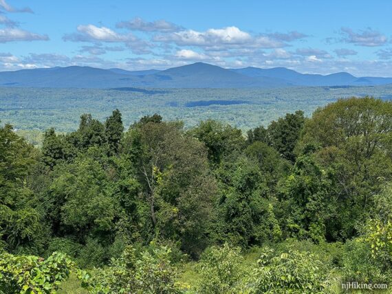
Reach another cool bench at the “Million Dollar View” just before returning to the lot.
—
Hiked: 8/13/24. Almost exactly 10 years later – totally not intentional!
Hiked: 8/15/14. Trail Blog: “The Gunks Overnighter: Sam’s Point and Bonticou Crag“
Updated: 9/2020 – Updated the scramble portion of Bonticou Accent Path to RED from YELLOW blazes but we haven’t re-hiked. Thanks to Shoko for the update. 4/2020: Page refreshed, not re-hiked.