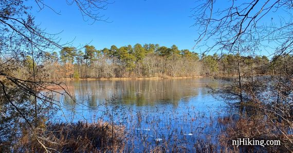
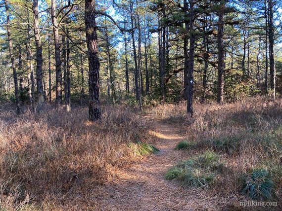
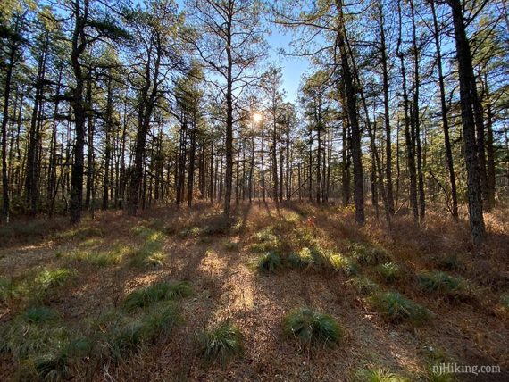
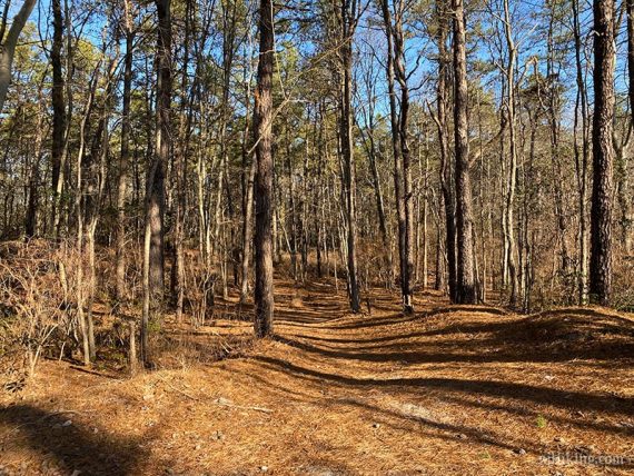
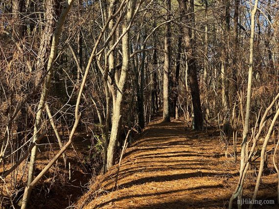
Hike through pretty pine forest, wetlands, and bogs.
5.0 miles or shorter, easy, flat, sandy trails. Can have wet areas.
| 5.0 miles | This hike guide: Detailed instructions and photos follow below. |
| Shorter | Several options noted below, or stick to the trails nearest the lot, suggested loops on the trail kiosk. |
| Longer | 7.0 – Include West side trails, noted in the description. This has a tricky water crossing, but that may change at any time. Extend using the Aerohaven section in the south park of the park (we’ve not done this) |
| Nearby | Atsion to Quaker Bridge; Rancocas State Park; Rancocas Nature Center; Tall Pines Preserve; Woods of Wenonah; Saddler’s Woods. |
Our two cents:
Great for easy, short hikes since many of the most interesting bits are not too far from the parking lot.
The trail system is flexible so it’s easy to create routes of varying lengths. We did a perimeter hike to get a longer hike in, but have noted multiple ways to shorten the route.
Kettle Run Road has rumble strips that are noisy as the Long Path gets closer to the road – in case you are wondering what that strange sound is.
Note: This is a non-hunting park. See Hiking in NJ During Hunting Season.
Update: 1/2025 – Page refreshed, minor edits; not re-hiked. Older change log at page bottom.
Hike Info:
Map/Books:
Print ahead or take a photo of the map on the kiosk in the lot. Follow along on your smartphone with our Interactive Map link above. Shorter hike in Best Day Hikes in New Jersey.
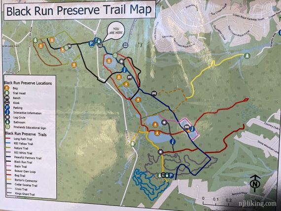
Note!!! Trail changes can be frequent at this park. There could be differences between the printed map and the map on the kiosk at the trailhead, and our map.
Some wooden signposts at intersections note the direction to the parking areas. Map on the trailhead kiosk (now outdated, there are more trails):
Parking: N39.84573° W74.89890°
Black Run Preserve Trailhead – Parking, Kettle Run Rd, Evesham, NJ 08053. From N.J. Turnpike South take Exit 4 to Rt 73 S; L on Braddock Mill, R as Braddock Mill merges on Tomlinson Mill Road briefly, L to continue on Braddock Mill, R on Kettle Run.
Pass the driveway for the Kettle Run West side lot on the right (additional spots here), then L into a small dirt lot for this hike. Detailed directions on park site.
At the other end of the park is a parking area on Borton’s Road (sand lot) as well as one on Tomlinson Mill Road (but the west side requires a difficult crossing to connect).
Restrooms:
Portable toilet in the Kettle Run lot as well as Borton’s Road Lot part-way through this hike. Also: We’ve used a Super WaWa on the left side of Rt 73 after exiting the Turnpike which is about 20 min. from the trailhead.
There is another smaller Wawa that is closer to the trailhead that we didn’t check, and multiple stores (Starbucks, Dunkin etc) on Rt. 73.
Hike Directions:
Overview: BLUE (PPT – Peaceful Partners Trail) – WHITE (Kettle) – BLUE (PPT) – 5k/GREEN – RED (Long Path) – 5k/GREEN – BLUE (PPT) – YELLOW (Borton’s Connector) – RED (Long)
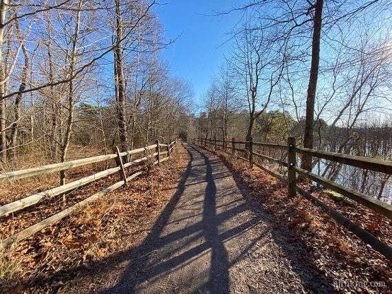
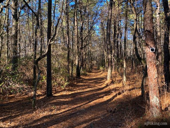
0.0 – Follow BLUE (PPT) past a trail kiosk then the beginning of RED (Long Path) on the right, near the start of a fence and wooden walkway. Just after the walkway, pass a trail leaving on the left.
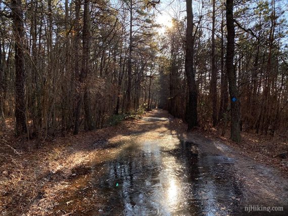
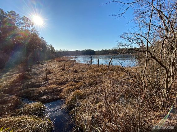
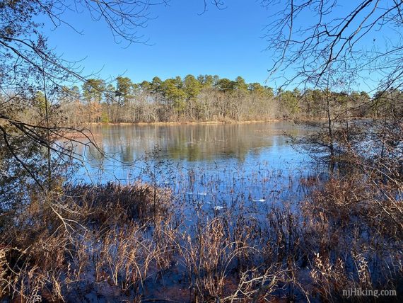
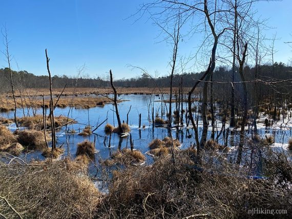
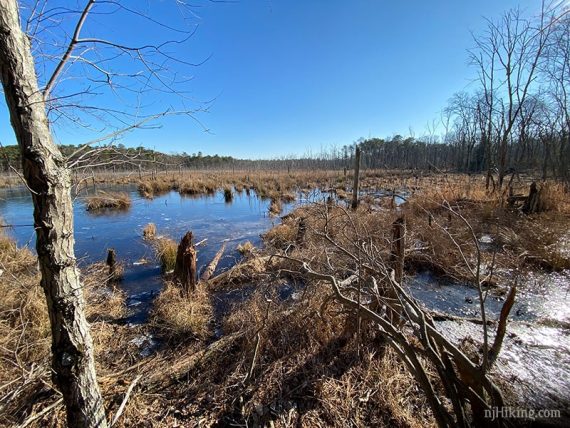
Continue on BLUE (PPT), a wide flat path that may have large wet areas after rain, past an intersection with BLACK (Black Run), then past viewing areas on the right at Shanty Bog and Crooked Dam Bog.
0.5 – Continue on BLUE (PPT) pass an intersection with BLACK (Black Run). Signpost has “38”.
0.7 – Turn LEFT to now follow WHITE (Kettle).
// Shorter Option: Continue straight on BLUE (PPT), skip WHITE, to cut the hike about 0.3 shorter.
1.0 – Turn RIGHT to continue on WHITE (Kettle). [YELLOW (Link) goes left and is an out-and-back to a golf course]
1.2 – Turn LEFT to follow BLUE (PPT) again.
1.3 – Turn LEFT and now follow 5k/GREEN (green on the map but we didn’t notice markers on the trail). Signpost has “19”.
// Shorter Option: Keep on BLUE (PPT) to cut the hike about 1.3 miles shorter].
1.5 – Turn LEFT and now follow RED (Long Path). RED (Long Path) an out-and-back on a sand road that returns to this point.
// Shorter Option: Stay on 5k/GREEN to cut 1.1 miles from the hike. This part was just OK if you are looking to reduce the mileage.
2.0 – RED (Long Path) does a little loop before heading back.
2.6 – Back where you were… Turn LEFT to follow 5k/GREEN again.
2.7 – Turn LEFT and follow BLUE (PPT) again. Continue on BLUE (PPT), passing an intersection [possibly white, silver, or marked out on the map; prior was 5K and RED (Long Path)]
Continue on BLUE (PPT) past an intersection with the REI trail, which is a winding biking trail that intersects BLUE (PPT) multiple times (so we did not mark them all).
BLUE (PPT) makes two right turns before winding over to the parking area on Borton’s Road where there is a trail kiosk/map and should be a portable toilet.
Note: When we last hiked here, the map showed additional trails on the other side of Borton’s Road that appeared to be twisty bike trails so we didn’t hike them. Since then, regular hiking trails have been added on this side, called Aero Haven, and all are on the map. Extend the hike by heading into this section.
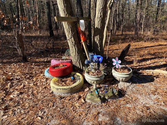
3.6 – Start following YELLOW (Borton’s). Pass a memorial with painted tires.
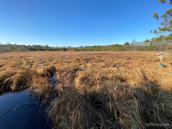
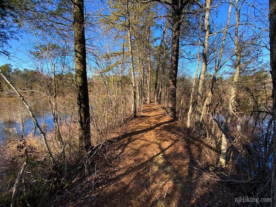
3.8 – Continue following YELLOW (Borton’s). [RED (Long) is off to the right]. The trail runs on a thin piece of land with bogs on either side.
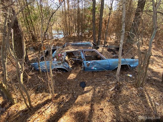
4.0 – Turn RIGHT at the end of the bogs, to continue on YELLOW (Borton’s) – though we didn’t spot blazes at first. [Optional: At this T-intersection, a brief jaunt to the left reaches an old car].
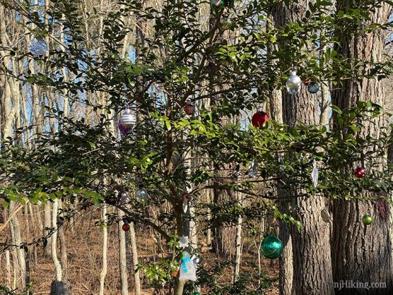
At the next junction, start following RED (Long) by going straight through a RED-YEL intersection. Signpost has “42”. [YELLOW goes left, RED also goes right.]
There were many ornaments in the trees at this intersection when we hiked this.
4.1 – Continue following RED (Long) past flooded WHITE (Kettle) (sign for 5K as well). Turn RIGHT to continue on RED (Long) when WHITE (Kettle) goes left.
4.4 – Continue following RED (Long) passing BLACK (Black Run) on the right.
4.6 – Turn RIGHT to follow RED (Long) back to the parking lot. [BLACK (Black Run) goes left, see below].
// Optional Add-on Adventure, for 7.0 miles total:
We turned LEFT on BLACK (Black Run) instead as we wanted to check out the West side trails like we did in 2016, even though we assumed they were still flooded dead-ends.
But now there was also a dicey water crossing. This isn’t a great option for the average hiker, so I cut it out of our main route.
I’ve included directions for the curious/adventurous. Plus, the condition of this crossing can easily change at any time as this park tends to get a lot of trail maintenance.
After turning LEFT, Follow BLACK (Black Run) to Kettle Run Road (busy) and cross it. Turn RIGHT and walk down the shoulder of the road to the trail turning LEFT back into the woods.
In a few steps, follow BLACK to the right where indicated.
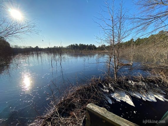
5.1 – BLACK ends. [A right leads back to the parking lot.] Turn LEFT, pass a trail sign, then quick RIGHT onto a Nature Trail. [The BLUE trail leads a short ways to where beavers flooded the trail out].
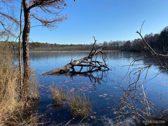
5.4 – Two very long wooden poles set over a large, deep-ish area of semi-frozen water. I believe the last time we hiked this (2016) this was a much narrower area of water with a wooden bridge.
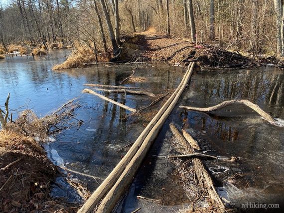
Hmmmm. We discussed the risk-vs-reward ratio and even though it was decidedly NOT in our favor we decided we’d like a wee bit of a challenge. We found some sticks to help cross and it was doable.
It was a tad woogey in the center, the sticks slipped against the ice or cracked through the ice, and a wrong move meant plunging a foot/leg into icy bog water.
Was it worth it? Probably not, considering the small amount of trail on the other side and likely having to re-cross this. But we knew that going in.
5.6 – Sign for a loop. Continue following that straight (can go either way though). The trail loops back around to this sign.
6.4 – Back at the sign, turn RIGHT.
Add 0.4 miles = In a bit we rambled off on another trail to the right and ended up at the other side of the beaver lodge flooding that is accessed from BLUE noted above. Look across to the trail – that is the end of the BLUE trail.
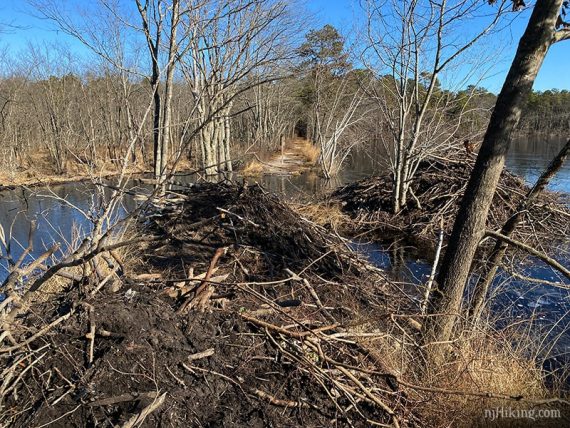
Soooo technically you can see this from the other side without dancing across a couple of skinny sticks. But WHERE’S THE FUN IN THAT?
Retrace and cross on those janky poles again. Back at the trail sign, continue straight. Head through the other parking area, and cross Kettle Run Road to return the main parking lot.
—
Hiked: 12/20/19.
Hiked: 1/17/16. Trail Blog: “Black Run Preserve in January“.
Update: 1/2020 – Re-hiked, route changed, description updated to reflect multiple trail system changes since originally hiked, new photos. Moved old hike description to the 1/2016 Trail Blog linked at the bottom of the page.