
Hike a loop with the Hibernia bat cave, cemetery, hawk watch viewpoint, and a beaver pond.
5.7 or 4.9 or 1.4 miles, total round trip. Rugged surface, lots of minor elevation changes with a somewhat steep climb in the beginning.
| 5.7 miles | This hike guide: Detailed instructions and photos follow below. |
| Shorter | 1.4 – Bat cave and cemetery loop. Noted below. 4.9 – Bat cave, cemetery, hawk watch loop. Noted below. |
| Nearby, same park | Four Birds Trail – Splitrock Reservoir; Four Birds Trail (North), Splitrock Reservoir Loop |
| Nearby | Pyramid Mountain – Tripod Rock; Valhalla Falls – Turkey Mountain; Turkey Mountain- Perimeter Loop; Mahlon Dickerson/Beaver Brook to Lost Lake |
| Nearby kayak | Splitrock Reservoir Kayak |
Our two cents:
This hike packs in the highlights of this section of Wildcat Ridge Wildlife Management Area – Hibernia mine / bat cave, Hibernia Cemetery (aka St. Patrick’s Cemetery), hawk watch viewpoint, and a beaver pond.
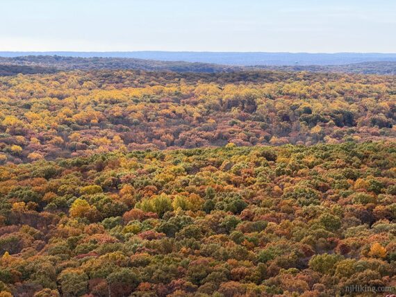
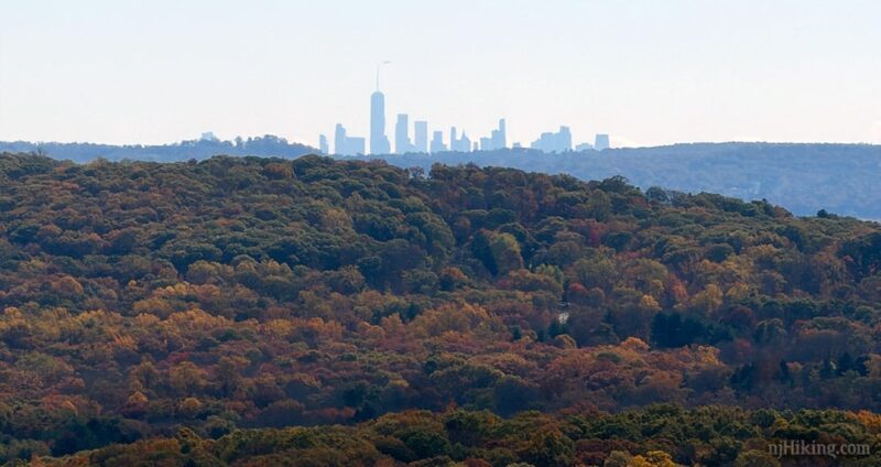
Volunteers count migrating hawks twice a year: February 15 to May 15 and August 15 to November 15. Great destination during fall foliage season, especially the view from the hawk watch (photo above).
The route uses part of the Four Birds trail that runs for 19.4 miles through Wildcat Ridge WMA and Farny State Park.
There are multiple trails and parking access points across this area to create shorter loops or longer and more challenging hikes.
Updated: 6/2026 – Revised the hike guide: changed focus to the 5.7 mile version, archived the outdated 12 mile version to it’s Trail Blog, replaced old photos and added more of key areas; re-hiked 10/2025. Older change log at page bottom.
Hike Info:
Map:
This area is covered on the Morris County Highlands Trails map set and is recommended to navigate the network of trails in this area. Follow along on your smartphone with our Interactive Map link above.
Books:
A 8.4 mile variation can be found in 60 Hikes Within 60 Miles: New York City. Two short and one long hike in the Farny Highlands are found in Hiking the Jersey Highlands.
Detailed trail description of the 19.4 mile long Four Bird Trail as well as others in Farny/Wildcat can be found in The New Jersey Walk Book.
Parking: N40.94473° W74.49293°
Wildcat Ridge, 25 Lower Hibernia Rd, Rockaway Township, NJ 07866. If approaching from Rt 80W take exit 37 (Hibernia/Rockaway), turn left onto 513 North (Green Pond Rd) for about 2.5 miles.
There is a large brown WMA sign for Wildcat Ridge – turn onto Lower Hibernia Rd then immediately turn left into the small dirt parking lot.
Restrooms:
None. Best bet are the two gas stations immediately after turning left onto 513, both have restrooms, or the Dunkin.
Hike Directions:
Overview: WHITE (Four Birds) – ORANGE (Hibernia Brook) – WHITE (Four Birds) – RED (Beaver Pond) – YELLOW (Wildcat Ridge) – ORANGE (Hibernia Brook) – WHITE (Four Birds)
Be alert for blazes throughout the route as there are unmarked trails and woods roads in this area.
0.0 – Start following WHITE (Four Birds) at the end of the lot.
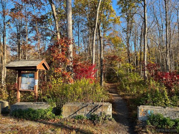
Shortly, ORANGE (Hibernia Brook) leaves to the left.
0.1 – The trail splits but both directions end up at the Hibernia Mine / bat cave in just a sec. Either follow the sign to the right or continue ahead on WHITE (Four Birds) a bit further, then turn RIGHT on a short unmarked path.
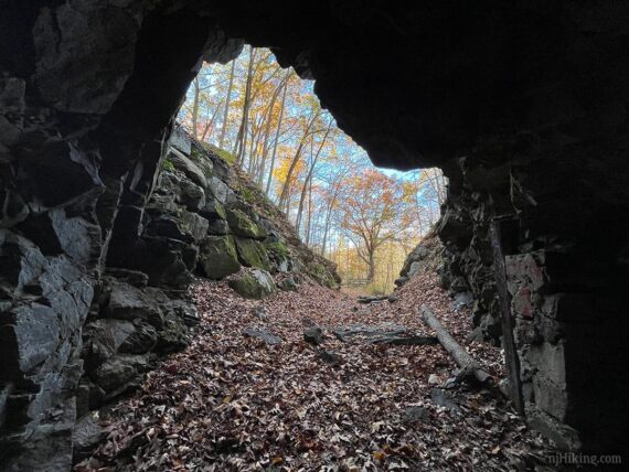
Arrive at the entrance to the Hibernia Mine and bat cave.
While we’re using “bat cave” for simplicity (and to get the batman theme stuck in your head – let’s be honest here) the technical term is bat hibernaculum – a winter shelter where bats hibernate.
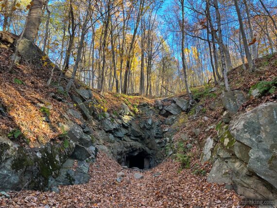
The Hibernia Mines were a series of iron mines worked in this area until the early 1900s. [see History of the Hibernia Mine for more info and vintage photos].
This mine contains New Jersey’s largest known bat hibernaculum. It once housed 20-30,000 bats every winter until the arrival of white-nose syndrome in 2009 wiped out 90% of the population.
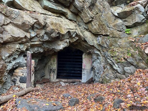
The mine is closed off but you can look inside, through the bars. This gate was modified in 2017 to enhance bat survival (post includes some photos inside the mine).
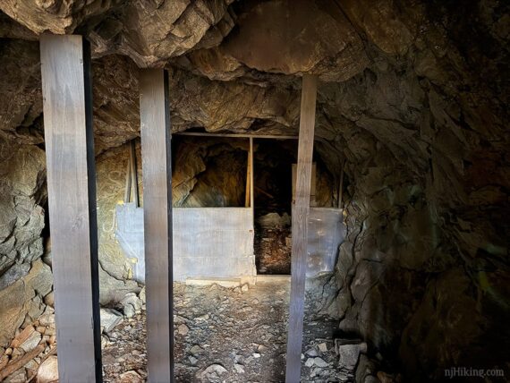
Standing at the mine entrance and looking back out:
When ready, return to WHITE (Four Birds) – with your back to the mine follow the brief unmarked trail ahead and then turn RIGHT to continue on WHITE (Four Birds).
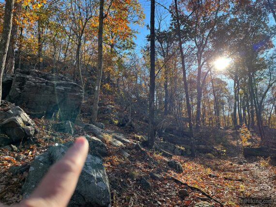
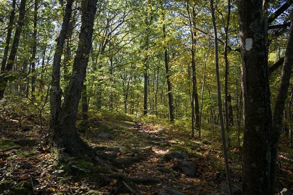
The first little bit of this trail isn’t particularly scenic, the road is visible and there is road noise but after a climb up a steep hill it starts to feel more remote.
0.4 – ORANGE (Hibernia Brook) crosses the trail. Veer RIGHT to continue ahead on WHITE (Four Birds) – a little easy to miss this and end up on ORANGE. You’ll return to this intersection on the way back.
The trail now follows a mining berm (mounded earth next to a ditch).
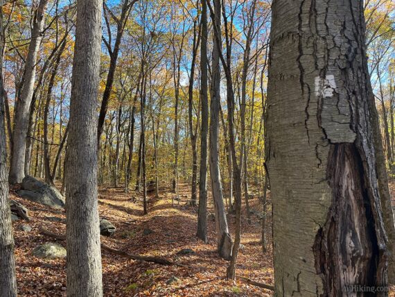
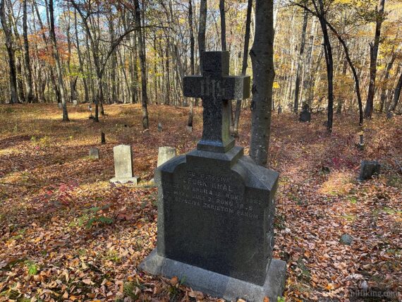
The Hibernia Cemetery may come into to view on the right, slightly in the distance, if the leaves are down. There were many fewer white crosses the last time we hiked here.
0.6 – At a T-intersection, turn RIGHT to follow a wide unmarked path to check out Hibernia Cemetery (also known as St. Patrick’s Cemetery). [WHITE (Four Birds) goes left, and will be where the route continues after the cemetery.]
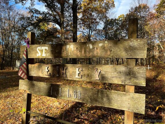
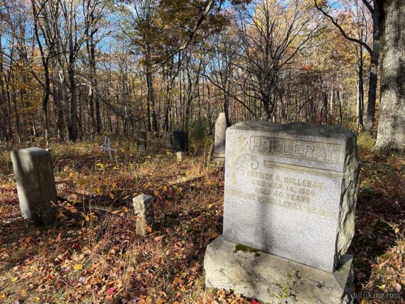
Fun Fact: Established in 1869, many graves are for miners who worked in the area and date back to the late 1800s. Over time the cemetery fell into neglect but has been adopted and restored by The Friendly Sons of St. Patrick of Morris County.

After exploring the cemetery, follow the unmarked trail back and turn RIGHT to continue following WHITE (Four Birds).
// Shorter loop, 1.4 mile hike: Instead of backtracking to WHITE, continue on the unmarked path through the cemetery. Turn RIGHT onto to ORANGE (Hibernia Brook) and follow that back to the intersection with WHITE (Four Birds). Turn LEFT and retrace WHITE (Four Birds) back to the lot. //
1.2 – Cross ORANGE (Hibernia Brook), continuing straight on WHITE (Four Birds). Cross several unmarked woods roads – not noted here because it’s uneeded – just keep following those white blazes.
2.6 – Pass RED (Meriden) on the right.
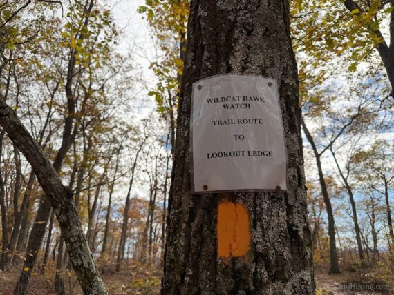
2.7 – Junction with ORANGE (Hibernia Brook). Turn RIGHT to follow ORANGE out to the hawk viewing area. There is a small sign on a tree several steps in.
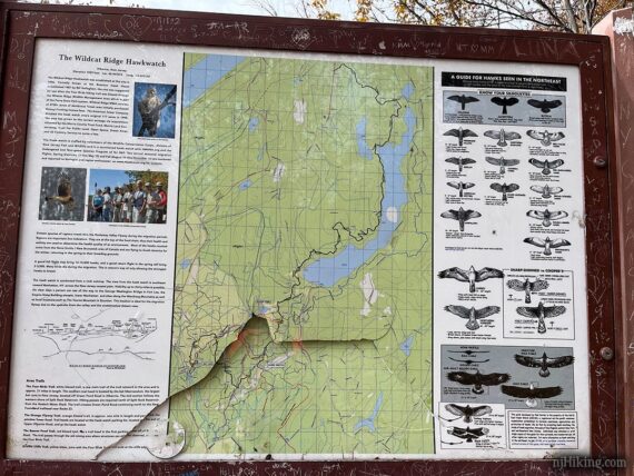
Soon arrive at an open ledge with a multi-sided informational sign.
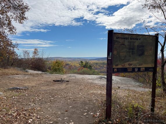
The sign contains an overview map, details about the hawk watch, a diagram showing the wing span patterns of different birds, and other information.
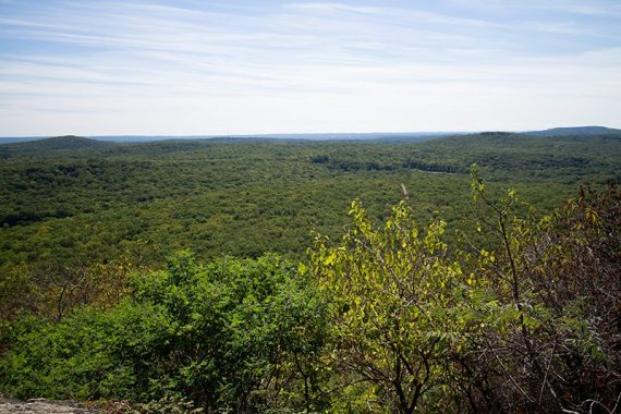
From the open ledge is a panoramic view. This is a nice spot to take a break (and have a snack… of course… one can never have enough snack breaks…) and watch hawks glide around in season.
Learn more: “How to Hawkwatch: A Beginner’s Guide to Observing Raptors“.

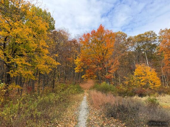
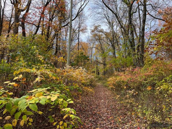
Time it just right and catch a riot of color during fall foliage season.

And of course it’s still beautiful when it’s a sea of green leaves, too.
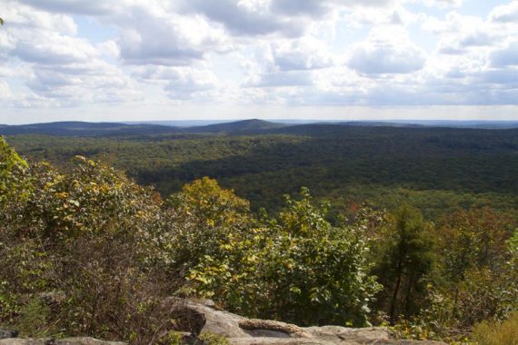
With clear enough conditions the New York City skyline may be visible in the distance. You’ll need to zoom in to see it well.
Retrace your steps back on ORANGE (Hibernia Brook) to where it met WHITE. Turn RIGHT to continue following WHITE (Four Birds) again.
// Shorter version – 4.9 miles, total round trip, skips Beaver Pond: Retrace ORANGE (Hibernia Brook) and cross over WHITE. Follow ORANGE (Hibernia Brook) – eventually pass YELLOW, then cross WHITE from earlier. At the 2nd junction with WHITE, turn LEFT and follow that back. If you miss that turn, ORANGE also leads back to the lot. //
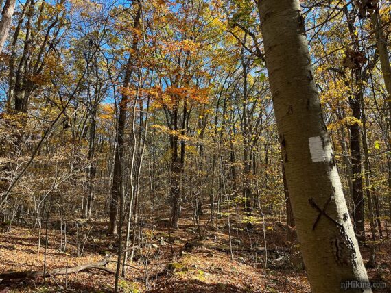
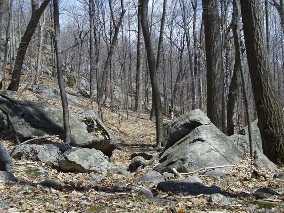
2.9 – Cross the large gravel service road and continue on WHITE (Four Birds). Trail descends through a rocky area.
3.3 – The white blazes were a bit unclear in this area – trail seemed to go on ahead but the blazes also jogged off to the left just to come back (probably a switchback for bikes).
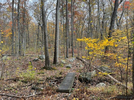
3.5 – Cross a small stream on a wooden foot bridge.
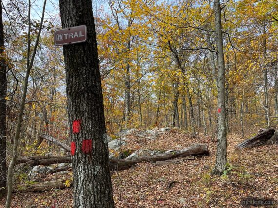
3.7 – This intersection may be easy to miss – turn LEFT to now follow RED (Beaver Pond). [WHITE (Four Birds) continues ahead, eventually reaching the Spitrock Reservoir area].
In this direction there were no markers but a small rock cairn – just one rock on another. In a few steps was a trail sign.
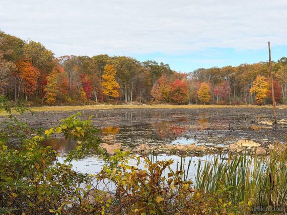
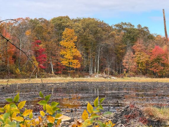
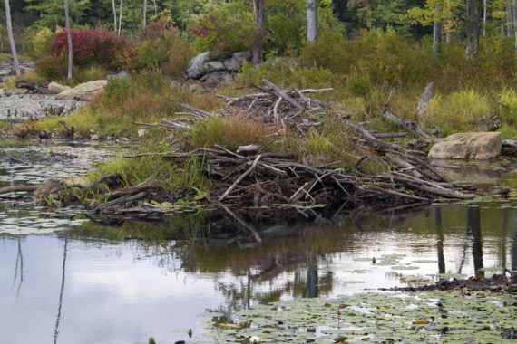
4.0 – A small pond appears, created from the work of some busy beavers.
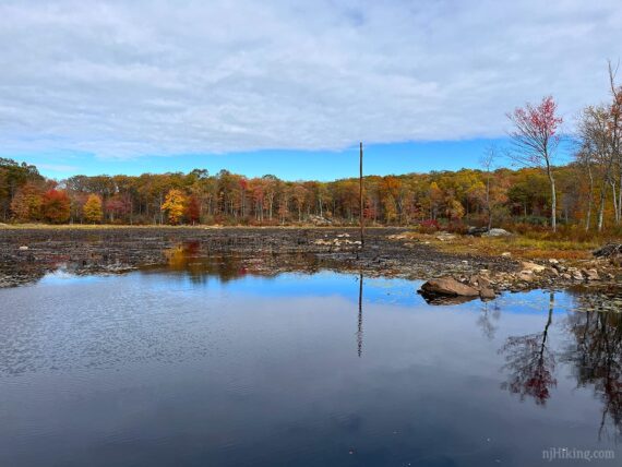
Water level can vary due to rain fall and what the beavers have been up to. Water level on our 10/2025 hike (and the foliage kickin’ it):
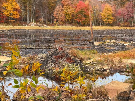
The lodging of those busy beavers:
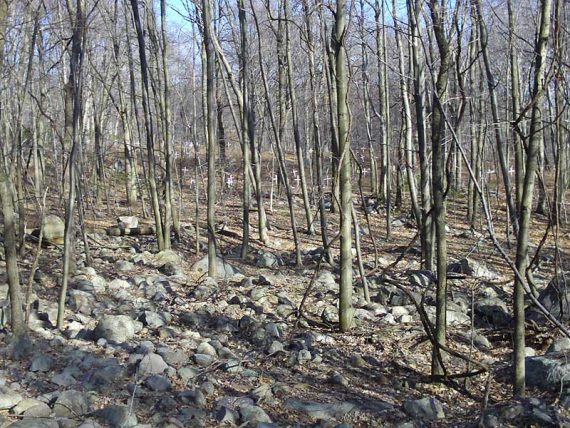
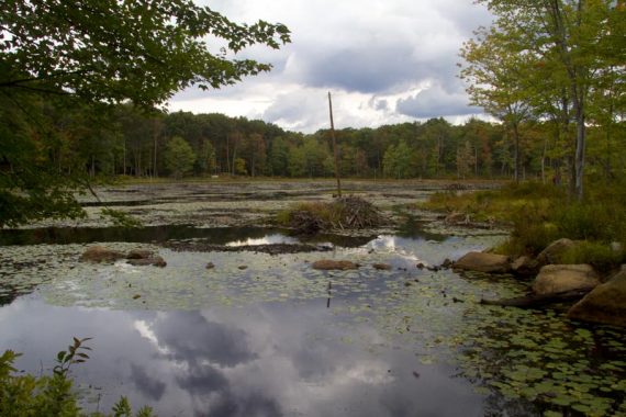
We’d last swung by the pond in 9/2012… time flies… and back then it looked like:
Continue following RED (Beaver Pond) along the pond.
4.2 – Arrive at the parking lot for the beaver pond. Walk through the lot and just before reaching the road, turn LEFT to now follow YELLOW (Wildcat Ridge). A few old buildings are off to the side.
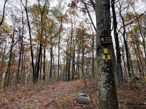
4.3 – YELLOW (Wildcat Ridge) makes a right and is running along a berm again.
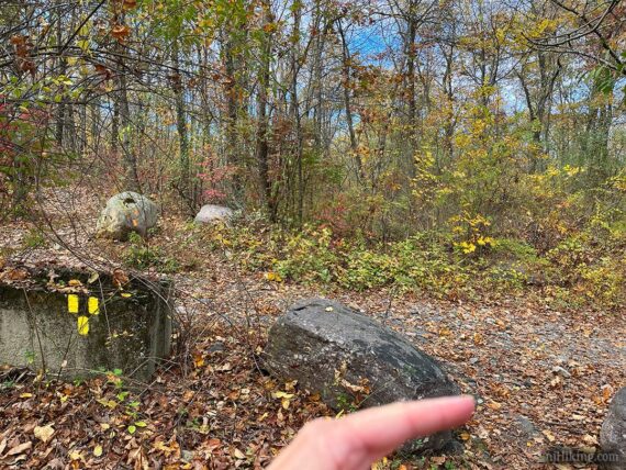
4.5 – YELLOW (Wildcat Ridge) ends at a junction with ORANGE (Hibernia Brook). There is a cement wall and large rocks. Turn RIGHT to now follow ORANGE (Hibernia Brook). [ORANGE (Hibernia Brook) also continues ahead.]
In a few steps, ORANGE (Hibernia Brook) turns LEFT. [To the right is another parking area]. In a few more steps ORANGE (Hibernia Brook) continues around a gate.
ORANGE (Hibernia Brook) rambles on uneventfully under power lines.
4.9 – Continue on ORANGE (Hibernia Brook) as it crosses WHITE (Four Birds)… this intersection was passed earlier.
5.2 – Continue on ORANGE (Hibernia Brook) past the unmarked trail that leads to the cemetery, on the right. A sign for the cemetery was facing in the other direction so this might not be noticed.
5.4 – ORANGE (Hibernia Brook) meets up with WHITE (Four Birds) from very early in the hike. Turn LEFT to follow WHITE (Four Birds) back to the lot. If you miss this for some reason, ORANGE (Hibernia Brook) also leads back to the lot.
—
Hiked: 10/25/25 (5.7 mile Variation): Four Birds, Hawk Watch, Beaver Pond loop
Hiked: 9/14/14 (Variation): Four Birds, Hawk Watch, Splitrock Res, Furnace
Hiked: 9/30/12 (5.7 mile Variation) Trail Blog: “Four Birds, Hawkwatch, Beaver Pond“
Hiked: 4/17/09. Trail Blog: “Four Birds Trail (south) – Wildcat Ridge“
Hiked: 4/21/07. Trail Blog: “Wildcat Ridge – Farny Highland“
Hiked: 10/8/06. Trail Blog: “Farny Highlands/Wildcat Ridge – Four Birds Trail“
Updated: 10/2025 – Minor edits/refresh; re-hiked a variation. 10/2020 Added directions for shorter versions. 7/2020 – Page refreshed, not re-hiked. Added photos.